
Nåvik topographic map
Click on the map to display elevation.
About this map
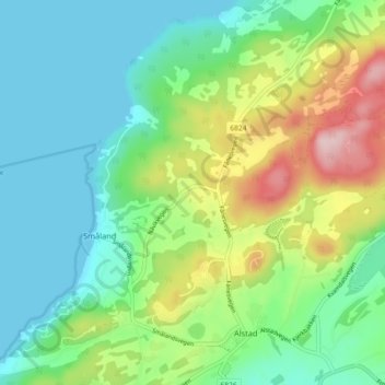
Name: Nåvik topographic map, elevation, terrain.
Location: Nåvik, Småland, Frosta, Trøndelag, 7633, Norway (63.58213 10.70786 63.62213 10.74786)
Average elevation: 73 m
Minimum elevation: 0 m
Maximum elevation: 246 m