Geolocate

Lodgepole topographic map

Click on the map to display elevation.

About this map

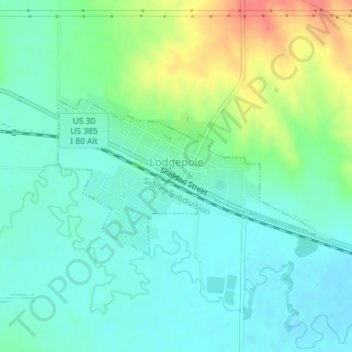
Name: Lodgepole topographic map, elevation, terrain.

Location: Lodgepole, Cheyenne County, Nebraska, United States (41.14257 -102.64840 41.15458 -102.62217)

Average elevation: 1,176 m

Minimum elevation: 1,158 m

Maximum elevation: 1,220 m

Gear up for your next adventure:

🧥Waterproof Hiking Jacket - Protect yourself from rain and wind while hiking
🧼Biodegradable Camp Soap - Environmentally friendly cleaning for gear and body
💡LED Camping Lantern - Illuminate your campsite with long-lasting lanterns
🧰Emergency Multi-Tool - Compact multi-tool for outdoor survival
🥤Collapsible Travel Cup - Saves space and weight in your mess kit

As an Amazon Associate, this site earns from qualifying purchases at no extra cost to you.