
Make a donation
Gear up for your next adventure:
As an Amazon Associate, this site earns from qualifying purchases at no extra cost to you.
Foreland topographic map
Click on the map to display elevation.
Make a donation
Gear up for your next adventure:
As an Amazon Associate, this site earns from qualifying purchases at no extra cost to you.
About this map
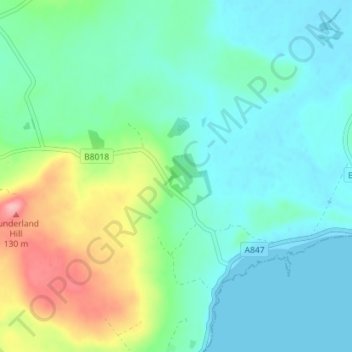
Name: Foreland topographic map, elevation, terrain.
Average elevation: 32 m
Minimum elevation: 0 m
Maximum elevation: 128 m
Make a donation
Gear up for your next adventure:
As an Amazon Associate, this site earns from qualifying purchases at no extra cost to you.
Other topographic maps
Click on a map to view its topography, its elevation and its terrain.
Coll
Vereinigtes Königreich > Schottland > Argyll and Bute > Arinagour
Coll (schottisch-gälisch: Cola; auch Eilean Cholla) ist eine Insel der Inneren Hebriden in der Council Area Argyll and Bute in Schottland. Sie liegt neun Kilometer nordwestlich der Isle of Mull. Coll ist etwa 19 Kilometer lang und knapp fünf Kilometer breit. Die höchste Erhebung ist der Ben Hogh im…
Average elevation: 7 m
Make a donation
Gear up for your next adventure:
As an Amazon Associate, this site earns from qualifying purchases at no extra cost to you.