Geolocate

Balibago Ⅰ topographic map

Click on the map to display elevation.

About this map

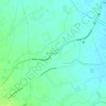
Name: Balibago Ⅰ topographic map, elevation, terrain.

Location: Balibago Ⅰ, Tarlac City, Tarlac, Central Luzon, Philippines (15.50282 120.60109 15.54282 120.64109)

Average elevation: 36 m

Minimum elevation: 31 m

Maximum elevation: 44 m

Other topographic maps

Click on a map to view its topography, its elevation and its terrain.

Maria Cristina Park

Philippines > Tarlac > Tarlac City

Average elevation: 48 m

San Rafael Creek

Philippines > Tarlac > Tarlac City

Average elevation: 41 m

Gear up for your next adventure:

🥾Approach Boots - Comfortable boots for hiking and climbing approaches
🛌Down Sleeping Bag - Superior warmth-to-weight ratio for cold nights
🥾Trail Hiking Shoes - Durable shoes designed for rugged trails
🛁Quick-Dry Microfiber Towel - Space-saving towel that dries rapidly on the move
🏕️Camping Hammock - Integrated protection for sleeping between trees

As an Amazon Associate, this site earns from qualifying purchases at no extra cost to you.