Geolocate

Widen topographic map

Click on the map to display elevation.

About this map

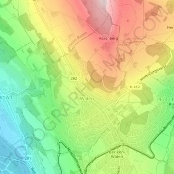
Name: Widen topographic map, elevation, terrain.

Location: Widen, Bezirk Bremgarten, Aargau, 8967, Switzerland (47.36003 8.34447 47.38281 8.36918)

Average elevation: 551 m

Minimum elevation: 360 m

Maximum elevation: 772 m

Other topographic maps

Click on a map to view its topography, its elevation and its terrain.

Hilfikon

Switzerland > Aargau > Bezirk Bremgarten

Average elevation: 533 m

Gear up for your next adventure:

❄️Traction Ice Cleats - Slip-on spikes for icy trails and winter hiking
🥾Durable Hiking Shoes - Long-lasting shoes for frequent hiking
🎒Backpack Rain Cover - External shield to keep your entire pack dry
🔋Lithium AA Batteries - Long-lasting power that performs in extreme cold
🥾Waterproof Hiking Shoes - Durable shoes for wet and rugged trails

As an Amazon Associate, this site earns from qualifying purchases at no extra cost to you.