
Thank you for supporting this site ❤️
Make a donation
Make a donation
Gear up for your next adventure:
As an Amazon Associate, this site earns from qualifying purchases at no extra cost to you.
Shahuwadi topographic map
Click on the map to display elevation.
Thank you for supporting this site ❤️
Make a donation
Make a donation
Gear up for your next adventure:
As an Amazon Associate, this site earns from qualifying purchases at no extra cost to you.
About this map
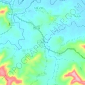
Name: Shahuwadi topographic map, elevation, terrain.
Location: Shahuwadi, Kolhapur District, Maharashtra, 416113, India (16.88462 73.92752 16.92462 73.96752)
Average elevation: 586 m
Minimum elevation: 554 m
Maximum elevation: 707 m
Thank you for supporting this site ❤️
Make a donation
Make a donation
Gear up for your next adventure:
As an Amazon Associate, this site earns from qualifying purchases at no extra cost to you.