
Thank you for supporting this site ❤️
Make a donation
Make a donation
Gear up for your next adventure:
As an Amazon Associate, this site earns from qualifying purchases at no extra cost to you.
Penajoia topographic map
Click on the map to display elevation.
Thank you for supporting this site ❤️
Make a donation
Make a donation
Gear up for your next adventure:
As an Amazon Associate, this site earns from qualifying purchases at no extra cost to you.
About this map
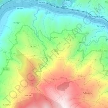
Name: Penajoia topographic map, elevation, terrain.
Location: Penajoia, Lamego, Viseu, 5100-666, Portugal (41.11975 -7.88013 41.15847 -7.82528)
Average elevation: 404 m
Minimum elevation: 43 m
Maximum elevation: 934 m
Thank you for supporting this site ❤️
Make a donation
Make a donation
Gear up for your next adventure:
As an Amazon Associate, this site earns from qualifying purchases at no extra cost to you.