Geolocate

Ferrara topographic map

Click on the map to display elevation.

About this map

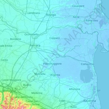
Name: Ferrara topographic map, elevation, terrain.

Location: Ferrara, Emilia-Romagna, Italy (44.54661 11.23575 44.98694 12.39871)

Average elevation: 13 m

Minimum elevation: -7 m

Maximum elevation: 566 m

Other topographic maps

Click on a map to view its topography, its elevation and its terrain.

Gear up for your next adventure:

💡Solar Camping Lamp - Eco-friendly lighting for campsites
🧴Sunscreen SPF - Broad-spectrum sunscreen for outdoor activities
🥾Light Trekking Boots - Supportive boots for multi-day treks
🧭GPS Tracker - Track your location in remote areas safely
👟Trail Running Shoes - Agile footwear for fast-paced topographic exploration

As an Amazon Associate, this site earns from qualifying purchases at no extra cost to you.