
Thank you for supporting this site ❤️
Make a donation
Make a donation
Gear up for your next adventure:
As an Amazon Associate, this site earns from qualifying purchases at no extra cost to you.
Otuto topographic map
Click on the map to display elevation.
Thank you for supporting this site ❤️
Make a donation
Make a donation
Gear up for your next adventure:
As an Amazon Associate, this site earns from qualifying purchases at no extra cost to you.
About this map
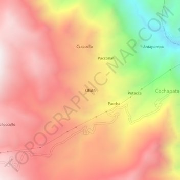
Name: Otuto topographic map, elevation, terrain.
Location: Otuto, Lucanas, Ayacucho, Perú (-14.69408 -74.25206 -14.65408 -74.21206)
Average elevation: 3,554 m
Minimum elevation: 2,691 m
Maximum elevation: 4,070 m
Thank you for supporting this site ❤️
Make a donation
Make a donation
Gear up for your next adventure:
As an Amazon Associate, this site earns from qualifying purchases at no extra cost to you.