Geolocate

Runisaidpur topographic map

Click on the map to display elevation.

About this map

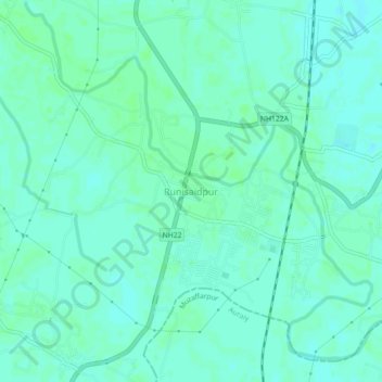
Name: Runisaidpur topographic map, elevation, terrain.

Location: Runisaidpur, Sitamarhi District, Bihar, India (26.37172 85.48567 26.41172 85.52567)

Average elevation: 58 m

Minimum elevation: 54 m

Maximum elevation: 61 m

Gear up for your next adventure:

🥾Waterproof Trail Shoes - Shoes designed to handle wet terrain
🥾Mountain Hiking Boots - High-traction boots for rocky terrain
🛶Canoe Life Vest - Safety vest for water sports
🧥Waterproof Pants - Keep dry during rainy hiking conditions
Backpacking Tent - Lightweight tent for long-distance hiking trips

As an Amazon Associate, this site earns from qualifying purchases at no extra cost to you.