
Syracuse topographic map
Click on the map to display elevation.
Syracuse
Geologically, the Syracuse area is part of the Hyblaean Mountains. Its topography consists of moderate peaks, the most prominent being the plateau of Epipoli, part of the easternmost Hyblaean foothills. At the base of Epipoli, located between the districts of Acradina and Neapolis, rises the Temenite Hill. The urban landscape is further marked by a rocky outcrop—rich in caves—known as the Crag of Akradina, with jagged walls of white limestone, referred to as the Syracuse white stone.
About this map
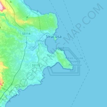
Name: Syracuse topographic map, elevation, terrain.
Location: Syracuse, Siracusa, Sicily, Italy (36.94771 15.08297 37.11567 15.33673)
Average elevation: 19 m
Minimum elevation: 0 m
Maximum elevation: 354 m
Other topographic maps
Click on a map to view its topography, its elevation and its terrain.