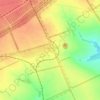
Krymske topographic map
Click on the map to display elevation.
About this map

Name: Krymske topographic map, elevation, terrain.
Average elevation: 78 m
Minimum elevation: 39 m
Maximum elevation: 162 m
Other topographic maps
Click on a map to view its topography, its elevation and its terrain.

Donets
The Donets originates on the Central Russian Upland, near Podolkhi village, Prokhorovka area, north of Belgorod, at an elevation of 200 m (660 ft) above sea level. Its basin contains over 3000 rivers, of which 425 are longer than 10 km (6.2 mi) and 11 are longer than 100 km (62 mi); 1011 of those rivers…
Average elevation: 45 m


Dibrova
Dibrova (Ukrainian: Діброва) is a village in the Sievierodonetsk Raion, Luhansk Oblast, Ukraine. It has a population of 338. Until 2016, it was known as Chervona Dibrova (Ukrainian: Червона Діброва). The village is located close to Kreminna and Pryvyllia, north of the Serebrianskiy Forest…
Average elevation: 103 m


Stelmakhivka
The village is located near the border of Luhansk and Kharkiv Oblasts, 20 kilometers from Svatove and 23 kilometers from the urban settlement of Borova. Administratively, the village was arranged into the Svatove Raion in 2020. The elevation is 146 meters.
Average elevation: 169 m