Geolocate

Janla topographic map

Click on the map to display elevation.

About this map

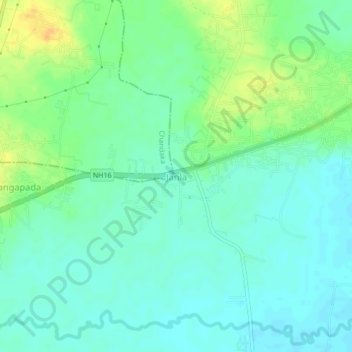
Name: Janla topographic map, elevation, terrain.

Location: Janla, Jatani, Khordha District, Odisha, 752050, India (20.18858 85.67294 20.22858 85.71294)

Average elevation: 31 m

Minimum elevation: 21 m

Maximum elevation: 49 m

Gear up for your next adventure:

🦟Insect Repellent - Keep mosquitoes and black flies away in wooded areas
🛰️Satellite Messenger - Emergency communication for areas with no cell service
💧Collapsible Water Bottle - Space-saving water bottle for outdoor activities
💧Hydration Pack - Hands-free hydration system for long hikes
❄️Traction Ice Cleats - Slip-on spikes for icy trails and winter hiking

As an Amazon Associate, this site earns from qualifying purchases at no extra cost to you.