
Roan Mountain State Park topographic map
Interactive map
Click on the map to display elevation.
About this map
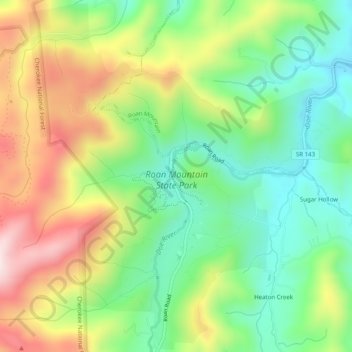
Name: Roan Mountain State Park topographic map, elevation, terrain.
Average elevation: 988 m
Minimum elevation: 801 m
Maximum elevation: 1,262 m
Roan Mountain State Park hosts a variety of outdoor activities including hiking, mountain biking, camping, cross-country skiing (during snowy, winter months), fishing, and swimming. A heated swimming pool is open from Memorial Day to mid-August. At an elevation of 2,972 feet (906 m), the outdoor swimming pool is at the highest elevation of any swimming pool within the Tennessee State Park System. Other attractions include the historic Miller homestead and the Roan Mountain Rhododendron Festival. The festival celebrates the blooming of the world's largest natural rhododendron garden, and it is held in the park annually, during the peak of the alpine catawba rhododendron bloom in late June.