Geolocate

March topographic map

Click on the map to display elevation.

About this map

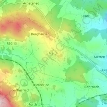
Name: March topographic map, elevation, terrain.

Location: March, Regen, Landkreis Regen, Bayern, Deutschland (48.95699 13.04806 48.99699 13.08806)

Average elevation: 627 m

Minimum elevation: 509 m

Maximum elevation: 850 m

Gear up for your next adventure:

🛏️Camping Sleeping Mat - Comfortable mats for sleeping outdoors
🩹Compact First Aid Kit - Pre-packed essentials for common trail injuries
🧤Rechargeable Heated Gloves - Extreme warmth for Canadian winter expeditions
🎒Backpack Rain Cover - External shield to keep your entire pack dry
🥾Durable Hiking Shoes - Long-lasting shoes for frequent hiking

As an Amazon Associate, this site earns from qualifying purchases at no extra cost to you.