Geolocate

Centerville topographic map

Click on the map to display elevation.

About this map

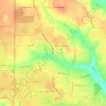
Name: Centerville topographic map, elevation, terrain.

Location: Centerville, Houston County, Georgia, 31028, United States (32.61786 -83.70944 32.66250 -83.65868)

Average elevation: 136 m

Minimum elevation: 103 m

Maximum elevation: 153 m

Other topographic maps

Click on a map to view its topography, its elevation and its terrain.

Gear up for your next adventure:

🚲MTB Frame Bag - Carry tools and maps directly on your bicycle frame
👟Trail Running Shoes - Agile footwear for fast-paced topographic exploration
🧴Sunscreen SPF - Broad-spectrum sunscreen for outdoor activities
🧥Softshell Jacket - Windproof and breathable jacket for hiking
🧰Emergency Multi-Tool - Compact multi-tool for outdoor survival

As an Amazon Associate, this site earns from qualifying purchases at no extra cost to you.