Geolocate

Vich topographic map

Click on the map to display elevation.

About this map

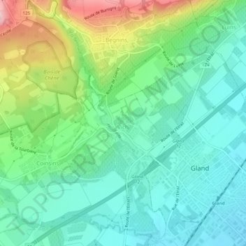
Name: Vich topographic map, elevation, terrain.

Location: Vich, District de Nyon, Vaud, 1267, Switzerland (46.41350 6.23186 46.44640 6.25904)

Average elevation: 474 m

Minimum elevation: 405 m

Maximum elevation: 644 m

Other topographic maps

Click on a map to view its topography, its elevation and its terrain.

Gear up for your next adventure:

🥾Hiking Shoes - Durable and comfortable shoes for trail hiking
🧰Survival Kit - Essential gear for emergencies in the wilderness
💧Hydration Bladder - Hands-free hydration solution for long treks
🛏️Camping Sleeping Mat - Comfortable mats for sleeping outdoors
Camping Tent - Weather-resistant tents suitable for 2 to 6 people

As an Amazon Associate, this site earns from qualifying purchases at no extra cost to you.