Geolocate

Mutuati topographic map

Click on the map to display elevation.

About this map

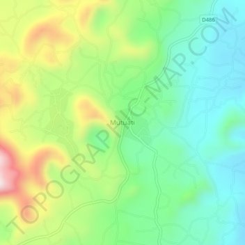
Name: Mutuati topographic map, elevation, terrain.

Location: Mutuati, Igembe North, Meru County, Eastern, Kenya (0.36173 37.95891 0.40173 37.99891)

Average elevation: 1,675 m

Minimum elevation: 1,498 m

Maximum elevation: 2,008 m

Gear up for your next adventure:

🥾Trail Hiking Socks - Comfortable socks to prevent blisters and fatigue
🧴Bear Spray Holster - Quick-access carry for essential Canadian wilderness safety
🧥Waterproof Jacket - Lightweight rain jackets for hiking and outdoor activities
🔋Emergency Crank Radio - Weather alerts and power without needing batteries
🛌Insulated Sleeping Pad - Critical thermal barrier between you and the cold ground

As an Amazon Associate, this site earns from qualifying purchases at no extra cost to you.