Geolocate

Aromas topographic map

Click on the map to display elevation.

About this map

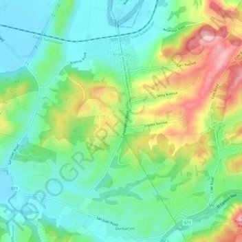
Name: Aromas topographic map, elevation, terrain.

Location: Aromas, Monterey County, California, United States (36.85695 -121.66877 36.89570 -121.61322)

Average elevation: 87 m

Minimum elevation: 17 m

Maximum elevation: 221 m

Gear up for your next adventure:

🥾Trail Hiking Socks - Comfortable socks to prevent blisters and fatigue
🛶Kayak Dry Bag - Waterproof storage for kayaking adventures
🥾Trail Hiking Boots - Supportive boots for rough trails
🥾Light Hiking Boots - Lightweight and comfortable boots for day hikes
🧢Outdoor Cap - Protective cap for sun and rain during hikes

As an Amazon Associate, this site earns from qualifying purchases at no extra cost to you.