Geolocate

Nairobi River topographic map

Click on the map to display elevation.

About this map
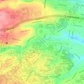
Name: Nairobi River topographic map, elevation, terrain.

Location: Nairobi River, Nairobi, P. O. BOX 66831, Kenya (-1.26739 36.77433 -1.26733 36.77450)

Average elevation: 1,763 m

Minimum elevation: 1,701 m

Maximum elevation: 1,818 m

Gear up for your next adventure:

🛁Quick-Dry Microfiber Towel - Space-saving towel that dries rapidly on the move
⛺Camping Tent - Weather-resistant tents suitable for 2 to 6 people
🛶Kayak Dry Bag - Waterproof storage for kayaking adventures
🧭GPS Outdoor Watch - Smart watch for navigation and fitness tracking in nature
🧦Thermal Socks - Warm socks for winter hiking or camping

As an Amazon Associate, this site earns from qualifying purchases at no extra cost to you.