Geolocate

Willey topographic map

Click on the map to display elevation.

About this map

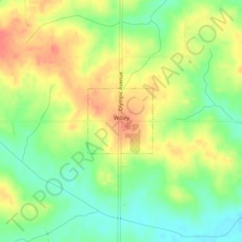
Name: Willey topographic map, elevation, terrain.

Location: Willey, Carroll County, Iowa, United States (41.97515 -94.82727 41.98243 -94.81750)

Average elevation: 390 m

Minimum elevation: 362 m

Maximum elevation: 417 m

Other topographic maps

Click on a map to view its topography, its elevation and its terrain.

Elk Run

United States > Iowa > Carroll County

Average elevation: 336 m

Gear up for your next adventure:

🛶Kayak Dry Bag - Waterproof storage for kayaking adventures
🧢Hiking Hat - Sun-protective and breathable hats for long treks
🛌Down Sleeping Bag - Superior warmth-to-weight ratio for cold nights
👟Trail Running Shoes - Agile footwear for fast-paced topographic exploration
🥾Trail Running Boots - Durable shoes designed for trail running

As an Amazon Associate, this site earns from qualifying purchases at no extra cost to you.