Geolocate

Concord topographic map

Click on the map to display elevation.

About this map

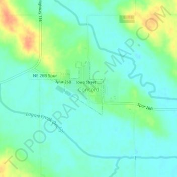
Name: Concord topographic map, elevation, terrain.

Location: Concord, Dixon County, Nebraska, United States (42.37962 -96.99436 42.38778 -96.98532)

Average elevation: 442 m

Minimum elevation: 429 m

Maximum elevation: 470 m

Gear up for your next adventure:

🥤Collapsible Travel Cup - Saves space and weight in your mess kit
🎒Fully Waterproof Backpack - Total protection for photography gear and electronics
🥾Hiking Leggings - Comfortable leggings for outdoor activities
🧤Insulated Winter Gloves - Heavy-duty protection for sub-zero Canadian adventures
👟Leg Gaiters - Keep debris, mud, and snow out of your boots

As an Amazon Associate, this site earns from qualifying purchases at no extra cost to you.