Geolocate

Castelmezzano topographic map

Click on the map to display elevation.

About this map

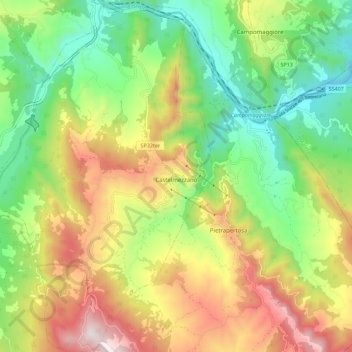
Name: Castelmezzano topographic map, elevation, terrain.

Location: Castelmezzano, Potenza, Basilicata, Italy (40.48836 15.98391 40.57355 16.05802)

Average elevation: 757 m

Minimum elevation: 348 m

Maximum elevation: 1,342 m

Other topographic maps

Click on a map to view its topography, its elevation and its terrain.

Agri

Italy > Basilicata > Potenza > San Martino d'Agri

Average elevation: 491 m

Gear up for your next adventure:

🧴First Aid Kit - Essential first aid supplies for outdoor emergencies
🧢Hiking Hat - Sun-protective and breathable hats for long treks
💡Solar Camping Lamp - Eco-friendly lighting for campsites
🔥Emergency Fire Starter - Reliable ignition source for all weather conditions
🔦LED Headtorch - Bright and durable light for night activities

As an Amazon Associate, this site earns from qualifying purchases at no extra cost to you.