
Thank you for supporting this site ❤️
Make a donation
Make a donation
Gear up for your next adventure:
As an Amazon Associate, this site earns from qualifying purchases at no extra cost to you.
Narepalli topographic map
Click on the map to display elevation.
Thank you for supporting this site ❤️
Make a donation
Make a donation
Gear up for your next adventure:
As an Amazon Associate, this site earns from qualifying purchases at no extra cost to you.
About this map
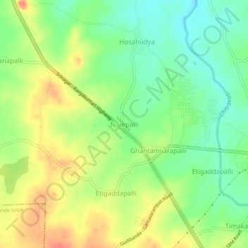
Name: Narepalli topographic map, elevation, terrain.
Location: Narepalli, Bagepalli taluk, Chikkaballapura, Karnataka, India (13.76878 77.75065 13.80878 77.79065)
Average elevation: 720 m
Minimum elevation: 695 m
Maximum elevation: 750 m
Thank you for supporting this site ❤️
Make a donation
Make a donation
Gear up for your next adventure:
As an Amazon Associate, this site earns from qualifying purchases at no extra cost to you.