
Mahina topographic map
Interactive map
Click on the map to display elevation.
About this map
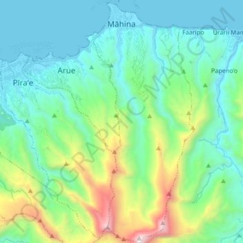
Name: Mahina topographic map, elevation, terrain.
Location: Mahina, Îles du Vent, Polinesia Francesa, 98709, Francia (-17.62172 -149.50324 -17.49332 -149.44738)
Average elevation: 474 m
Minimum elevation: 0 m
Maximum elevation: 2,145 m