
Pruppach topographic map
Click on the map to display elevation.
About this map
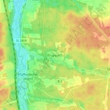
Name: Pruppach topographic map, elevation, terrain.
Location: Pruppach, Roth, Landkreis Roth, Bayern, 91154, Deutschland (49.25581 11.07623 49.29581 11.11623)
Average elevation: 346 m
Minimum elevation: 319 m
Maximum elevation: 371 m
Other topographic maps
Click on a map to view its topography, its elevation and its terrain.
Rothsee (Hauptsperre)
Deutschland > Bayern > Landkreis Roth > Roth > Eichelburg
Durch ein Einlaufbauwerk am Hauptdamm fließen aus dem Main-Donau-Kanal maximal 21 m³/s zu, abgegeben werden maximal 15 m³/s Wasser. Das Kraftwerk Rothsee I nutzt das aus dem See abgegebene Wasser für zwei Turbinen: eine Durchströmturbine für maximal 1 m³/s Durchfluss, die bei niedrigen Abflüssen…
Average elevation: 382 m