Geolocate

Mitchell topographic map

Click on the map to display elevation.

About this map

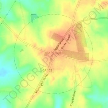
Name: Mitchell topographic map, elevation, terrain.

Location: Mitchell, Glascock County, Georgia, United States (33.20986 -82.71515 33.22973 -82.69156)

Average elevation: 150 m

Minimum elevation: 119 m

Maximum elevation: 173 m

Gear up for your next adventure:

💡Solar Camping Lamp - Eco-friendly lighting for campsites
🧥Waterproof Hiking Jacket - Protect yourself from rain and wind while hiking
👟Trail Running Shoes - Agile footwear for fast-paced topographic exploration
🧢Sun Protection Cap - Breathable cap to protect from sun exposure
🪑Insulated Seat Pad - Protect your seat from cold rocks and wet logs

As an Amazon Associate, this site earns from qualifying purchases at no extra cost to you.