Geolocate

Brugaro topographic map

Click on the map to display elevation.

About this map

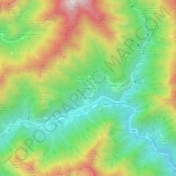
Name: Brugaro topographic map, elevation, terrain.

Location: Brugaro, Cravagliana, Vercelli, Piemonte, Italia (45.83687 8.20795 45.87687 8.24795)

Average elevation: 902 m

Minimum elevation: 496 m

Maximum elevation: 1,521 m

Gear up for your next adventure:

🎒Hiking Backpack - Lightweight and ergonomic backpacks for day hikes or multi-day treks
🗺️Topographic Maps - Detailed maps to explore trails, mountains, and wilderness areas
🧭Orienteering Kit - Tools for map reading and navigation in the wild
Backpacking Tent - Lightweight tent for long-distance hiking trips
🥾Lightweight Hiking Shoes - Comfortable shoes for day hikes

As an Amazon Associate, this site earns from qualifying purchases at no extra cost to you.