Geolocate

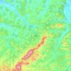
Treznea topographic map

Click on the map to display elevation.

Treznea

The commune is situated in the foothills of the Meseș Mountains, at an altitude of 304 m (997 ft), on the banks of the river Treznea. It is located in the central-south part of Sălaj County, at a distance of 14 km (8.7 mi) from the county seat, Zalău.

Wikipedia (CC-BY-SA 3.0)

About this map

Name: Treznea topographic map, elevation, terrain.

Location: Treznea, Sălaj, Romania (47.07211 23.01695 47.13683 23.15686)

Average elevation: 385 m

Minimum elevation: 254 m

Maximum elevation: 706 m

Other topographic maps

Click on a map to view its topography, its elevation and its terrain.

Bădăcin

Romania > Sălaj

Average elevation: 278 m

Valea Loznei

Romania > Sălaj

Average elevation: 413 m

Jac

Romania > Sălaj

Average elevation: 282 m

Treznea

Romania > Sălaj

Average elevation: 369 m

Zalău

Romania > Sălaj

The city includes a total surface of 90.09 km2 (34.78 sq mi). This includes the one village it administers, Stâna (Felsőnyárló), situated south-east of Meseș, in the hydrographic basin of the Agrij River. Măgura Stânii is at an altitude of 716 m (2,349 ft).

Average elevation: 321 m

Var

Romania > Sălaj > Jibou

Average elevation: 238 m

Baica

Romania > Sălaj

Average elevation: 313 m

Ciglean

Romania > Sălaj

Average elevation: 300 m

Turbuța

Romania > Sălaj

Average elevation: 245 m

Zalău

Romania > Sălaj

The city includes a total surface of 90.09 km2 (34.78 sq mi). This includes the one village it administers, Stâna (Felsőnyárló), situated south-east of Meseș, in the hydrographic basin of the Agrij River. Măgura Stânii is at an altitude of 716 m (2,349 ft).

Average elevation: 321 m

Moigrad-Porolissum

Romania > Sălaj

Average elevation: 366 m

Zalău

Romania > Sălaj

The city includes a total surface of 90.09 km2 (34.78 sq mi). This includes the one village it administers, Stâna (Felsőnyárló), situated south-east of Meseș, in the hydrographic basin of the Agrij River. Măgura Stânii is at an altitude of 716 m (2,349 ft).

Average elevation: 317 m
Mal

Romania > Sălaj

Average elevation: 388 m

Adalin

Romania > Sălaj

Average elevation: 401 m

Tihău

Romania > Sălaj

Average elevation: 250 m

Husia

Romania > Sălaj > Jibou

Average elevation: 246 m

Fabrica

Romania > Sălaj

Average elevation: 357 m

Stana

Romania > Sălaj

Average elevation: 477 m

Bic

Romania > Sălaj

Average elevation: 318 m

Moigrad-Porolissum

Romania > Sălaj

Average elevation: 366 m

Mesteacănu

Romania > Sălaj

Average elevation: 453 m

Cozla

Romania > Sălaj

Average elevation: 417 m

Gear up for your next adventure:

🛶Kayak Dry Bag - Waterproof storage for kayaking adventures
🛁Quick-Dry Microfiber Towel - Space-saving towel that dries rapidly on the move
🥾Lightweight Hiking Shoes - Comfortable shoes for day hikes
🧥Thermal Fleece Jacket - Versatile insulation for changing mountain temperatures
🔥Emergency Fire Starter - Reliable ignition source for all weather conditions

As an Amazon Associate, this site earns from qualifying purchases at no extra cost to you.