
Pelham topographic map
Click on the map to display elevation.
About this map
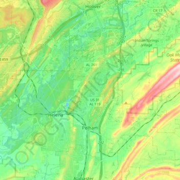
Name: Pelham topographic map, elevation, terrain.
Location: Pelham, Shelby County, Alabama, United States (33.24289 -86.83075 33.38996 -86.66577)
Average elevation: 173 m
Minimum elevation: 77 m
Maximum elevation: 375 m
Other topographic maps
Click on a map to view its topography, its elevation and its terrain.