Geolocate

Macabud topographic map

Click on the map to display elevation.

About this map

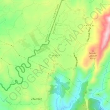
Name: Macabud topographic map, elevation, terrain.

Location: Macabud, Rizal, Calabarzon, Philippines (14.77757 121.11947 14.81757 121.15947)

Average elevation: 225 m

Minimum elevation: 75 m

Maximum elevation: 440 m

Gear up for your next adventure:

🧤Thermal Hiking Gloves - Grip-enhanced gloves for cold-weather altitude trekking
🧥Waterproof Pants - Keep dry during rainy hiking conditions
👟Sport Hiking Sandals - Breathable footwear for water crossings and camp rest
🧶550 Survival Paracord - Versatile utility cord for emergency repairs and rigging
📷Outdoor Action Camera - Capture high-elevation views and rugged adventures

As an Amazon Associate, this site earns from qualifying purchases at no extra cost to you.