Geolocate

Fraser topographic map

Click on the map to display elevation.

About this map

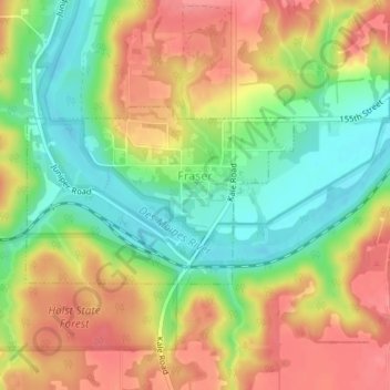
Name: Fraser topographic map, elevation, terrain.

Location: Fraser, Boone County, Iowa, United States (42.11898 -93.98439 42.13127 -93.95933)

Average elevation: 307 m

Minimum elevation: 266 m

Maximum elevation: 346 m

Other topographic maps

Click on a map to view its topography, its elevation and its terrain.

Ledges State Park

United States > Iowa > Boone County

Average elevation: 308 m

Gear up for your next adventure:

🧥Softshell Jacket - Windproof and breathable jacket for hiking
🔭Outdoor Binoculars - Lightweight binoculars for birdwatching and hiking
🥾Mountain Trail Shoes - High-traction shoes for mountain trails
🥾Light Hiking Boots - Lightweight and comfortable boots for day hikes
🧦Thermal Socks - Warm socks for winter hiking or camping

As an Amazon Associate, this site earns from qualifying purchases at no extra cost to you.