
Thank you for supporting this site ❤️
Make a donation
Make a donation
Gear up for your next adventure:
As an Amazon Associate, this site earns from qualifying purchases at no extra cost to you.
Zams topographic map
Click on the map to display elevation.
Thank you for supporting this site ❤️
Make a donation
Make a donation
Gear up for your next adventure:
As an Amazon Associate, this site earns from qualifying purchases at no extra cost to you.
About this map
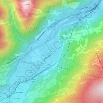
Name: Zams topographic map, elevation, terrain.
Location: Zams, Gemeinde Zams, Bezirk Landeck, Tirol, 6511, Österreich (47.13829 10.56906 47.17829 10.60906)
Average elevation: 1,124 m
Minimum elevation: 750 m
Maximum elevation: 2,004 m
Thank you for supporting this site ❤️
Make a donation
Make a donation
Gear up for your next adventure:
As an Amazon Associate, this site earns from qualifying purchases at no extra cost to you.