Geolocate

Birendranagar topographic map

Click on the map to display elevation.

About this map

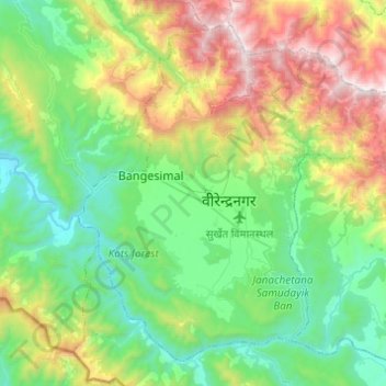
Name: Birendranagar topographic map, elevation, terrain.

Location: Birendranagar, Surkhet, Karnali Pradesh, 21700, Nepal (28.50558 81.53270 28.69207 81.77675)

Average elevation: 926 m

Minimum elevation: 342 m

Maximum elevation: 2,252 m

Gear up for your next adventure:

Lightweight Backpacking Tent - Compact tent for efficient hiking trips
🧭GPS Outdoor Watch - Smart watch for navigation and fitness tracking in nature
🥾Waterproof Hiking Shoes - Durable shoes for wet and rugged trails
🚲Handlebar Phone Mount - View topographic-map.com live while cycling
🥾Hiking Boots - Sturdy boots providing ankle support and traction on rugged trails

As an Amazon Associate, this site earns from qualifying purchases at no extra cost to you.