Geolocate

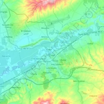
Chlef topographic map

Click on the map to display elevation.

Chlef

Chlef lies in a valley at an elevation of 114 metres (374 ft) between two ranges of hills to the north and west. The city is surrounded by farmland; there are scattered trees both in the valley and on the hills.

Wikipedia (CC-BY-SA 3.0)

About this map

Name: Chlef topographic map, elevation, terrain.

Location: Chlef, Chlef District, Chlef, 02000, Algeria (36.09029 1.25950 36.24885 1.44872)

Average elevation: 179 m

Minimum elevation: 76 m

Maximum elevation: 522 m

Gear up for your next adventure:

🎒Fully Waterproof Backpack - Total protection for photography gear and electronics
🗺️Topographic Maps - Detailed maps to explore trails, mountains, and wilderness areas
🔭Compact Monocular - One-handed bird watching and trail spotting
🌡️Emergency Mylar Blankets - Compact thermal protection for unexpected nights outdoors
🧥Thermal Fleece Jacket - Versatile insulation for changing mountain temperatures

As an Amazon Associate, this site earns from qualifying purchases at no extra cost to you.