
Thank you for supporting this site ❤️
Make a donation
Make a donation
Gear up for your next adventure:
As an Amazon Associate, this site earns from qualifying purchases at no extra cost to you.
Rombo topographic map
Click on the map to display elevation.
Thank you for supporting this site ❤️
Make a donation
Make a donation
Gear up for your next adventure:
As an Amazon Associate, this site earns from qualifying purchases at no extra cost to you.
About this map
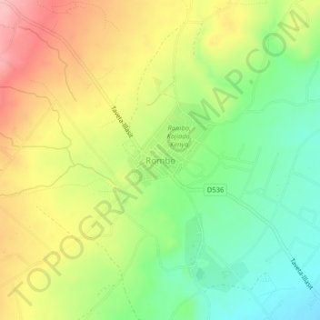
Name: Rombo topographic map, elevation, terrain.
Location: Rombo, Rombo ward, Loitokitok, Rift Valley, Kenya (-3.06700 37.67506 -3.02700 37.71506)
Average elevation: 1,170 m
Minimum elevation: 1,103 m
Maximum elevation: 1,249 m
Thank you for supporting this site ❤️
Make a donation
Make a donation
Gear up for your next adventure:
As an Amazon Associate, this site earns from qualifying purchases at no extra cost to you.