
Thank you for supporting this site ❤️
Make a donation
Make a donation
Gear up for your next adventure:
As an Amazon Associate, this site earns from qualifying purchases at no extra cost to you.
Cabanelas topographic map
Click on the map to display elevation.
Thank you for supporting this site ❤️
Make a donation
Make a donation
Gear up for your next adventure:
As an Amazon Associate, this site earns from qualifying purchases at no extra cost to you.
About this map
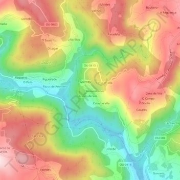
Name: Cabanelas topographic map, elevation, terrain.
Location: Cabanelas, O Carballiño, Ourense, Galicia, 32516, España (42.37770 -8.15508 42.41770 -8.11508)
Average elevation: 279 m
Minimum elevation: 88 m
Maximum elevation: 465 m
Thank you for supporting this site ❤️
Make a donation
Make a donation
Gear up for your next adventure:
As an Amazon Associate, this site earns from qualifying purchases at no extra cost to you.