Geolocate

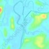
Malayog topographic map

Click on the map to display elevation.

About this map

Name: Malayog topographic map, elevation, terrain.

Location: Malayog, Calbayog, Samar, Eastern Visayas, 6710, Philippines (12.17295 124.37880 12.21295 124.41880)

Average elevation: 55 m

Minimum elevation: -1 m

Maximum elevation: 288 m

Other topographic maps

Click on a map to view its topography, its elevation and its terrain.
Gear up for your next adventure:

🥾Trail Hiking Shoes - Durable shoes designed for rugged trails
🧭GPS Tracker - Track your location in remote areas safely
🎒Hiking Backpack - Lightweight and ergonomic backpacks for day hikes or multi-day treks
🚑Survival Whistle - Signal for help across long distances in mountains
🛶Canoe Life Vest - Safety vest for water sports

As an Amazon Associate, this site earns from qualifying purchases at no extra cost to you.