Geolocate

Shigao topographic map

Click on the map to display elevation.

About this map

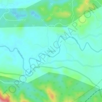
Name: Shigao topographic map, elevation, terrain.

Location: Shigao, Dharbandora, South Goa, Goa, India (15.31469 74.18701 15.35469 74.22701)

Average elevation: 81 m

Minimum elevation: 37 m

Maximum elevation: 247 m

Other topographic maps

Click on a map to view its topography, its elevation and its terrain.

Codli

India > Goa > Dharbandora

Average elevation: 66 m

Gear up for your next adventure:

🧭Orienteering Kit - Tools for map reading and navigation in the wild
🌡️Emergency Mylar Blankets - Compact thermal protection for unexpected nights outdoors
🥾Trail Hiking Boots - Supportive boots for rough trails
🚲Heavy Duty Bike Lock - Secure your bike at the trailhead or during stops
🧥Fleece Jacket - Warm and lightweight jacket for layering

As an Amazon Associate, this site earns from qualifying purchases at no extra cost to you.