Geolocate

Schwanham topographic map

Click on the map to display elevation.

About this map
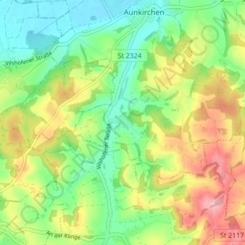
Name: Schwanham topographic map, elevation, terrain.

Location: Schwanham, Vilshofen an der Donau, Landkreis Passau, Bayern, 94501, Deutschland (48.56067 13.10526 48.60067 13.14526)

Average elevation: 369 m

Minimum elevation: 313 m

Maximum elevation: 450 m

Other topographic maps

Click on a map to view its topography, its elevation and its terrain.

Gear up for your next adventure:

🚲MTB Frame Bag - Carry tools and maps directly on your bicycle frame
🩹Compact First Aid Kit - Pre-packed essentials for common trail injuries
👖Convertible Hiking Pants - Zip-off legs to adapt to changing weather conditions
☕Camping Coffee Maker - Brew fresh coffee anywhere on the topographic map
🔦LED Headtorch - Bright and durable light for night activities

As an Amazon Associate, this site earns from qualifying purchases at no extra cost to you.