Geolocate

Campeche topographic map

Click on the map to display elevation.

About this map

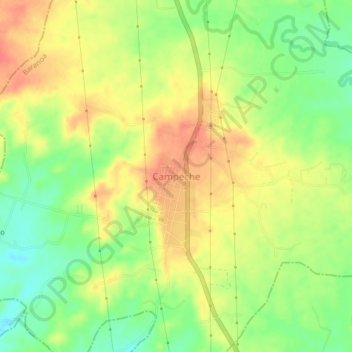
Name: Campeche topographic map, elevation, terrain.

Location: Campeche, Atlántico, Colombia (10.70776 -74.93398 10.74776 -74.89398)

Average elevation: 92 m

Minimum elevation: 64 m

Maximum elevation: 114 m

Gear up for your next adventure:

🕶️Polarized Sunglasses - Reduces glare from snow and water at high elevations
🌡️Emergency Mylar Blankets - Compact thermal protection for unexpected nights outdoors
🧥Thermal Layer - Insulating layer for cold outdoor conditions
🥾Waterproof Trail Shoes - Shoes designed to handle wet terrain
🧼Travel Hand Sanitizer - Keep hands clean when water is scarce

As an Amazon Associate, this site earns from qualifying purchases at no extra cost to you.