Geolocate

Trebur topographic map

Click on the map to display elevation.

About this map

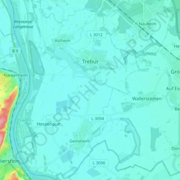
Name: Trebur topographic map, elevation, terrain.

Location: Trebur, Kreis Groß-Gerau, Hesse, 65468, Germany (49.86080 8.34102 49.95803 8.44676)

Average elevation: 88 m

Minimum elevation: 79 m

Maximum elevation: 192 m

Gear up for your next adventure:

🔦LED Flashlight - Powerful and long-lasting flashlight for camping and emergencies
🧢Outdoor Cap - Protective cap for sun and rain during hikes
🔦LED Headlamp - Hands-free lighting for early morning starts or late finishes
🧥Softshell Jacket - Windproof and breathable jacket for hiking
🦶Anti-Blister Balm - Prevents friction and hotspots during long ascents

As an Amazon Associate, this site earns from qualifying purchases at no extra cost to you.