Geolocate

Jesus Maria topographic map

Click on the map to display elevation.

About this map

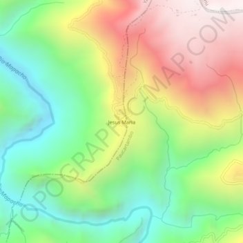
Name: Jesus Maria topographic map, elevation, terrain.

Location: Jesus Maria, Yanatile, Calca, Cusco, Perú (-12.97270 -71.84932 -12.93270 -71.80932)

Average elevation: 2,863 m

Minimum elevation: 2,209 m

Maximum elevation: 3,751 m

Gear up for your next adventure:

🥾Trekking Boots - Durable boots for long-distance trekking
🧥Waterproof Hiking Jacket - Protect yourself from rain and wind while hiking
💡Compact LED Flashlight - Powerful and portable flashlight for outdoor use
💡Portable Camping Lamp - Rechargeable lamp for campsite lighting
🥾Hiking Gaiters - Protect legs and shoes from mud, snow, and debris

As an Amazon Associate, this site earns from qualifying purchases at no extra cost to you.