
Thank you for supporting this site ❤️
Make a donation
Make a donation
Gear up for your next adventure:
As an Amazon Associate, this site earns from qualifying purchases at no extra cost to you.
Amlang topographic map
Click on the map to display elevation.
Thank you for supporting this site ❤️
Make a donation
Make a donation
Gear up for your next adventure:
As an Amazon Associate, this site earns from qualifying purchases at no extra cost to you.
About this map
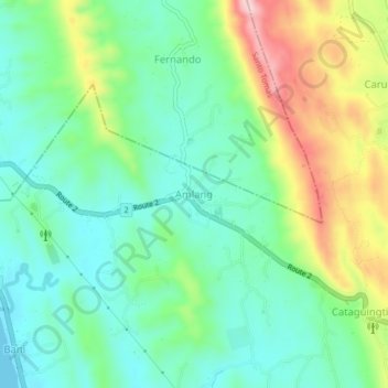
Name: Amlang topographic map, elevation, terrain.
Location: Amlang, Rosario, La Union, Ilocos Region, 2506, Philippines (16.21694 120.41134 16.25694 120.45134)
Average elevation: 80 m
Minimum elevation: 0 m
Maximum elevation: 250 m
Thank you for supporting this site ❤️
Make a donation
Make a donation
Gear up for your next adventure:
As an Amazon Associate, this site earns from qualifying purchases at no extra cost to you.