Geolocate

Almerimar topographic map

Click on the map to display elevation.

About this map

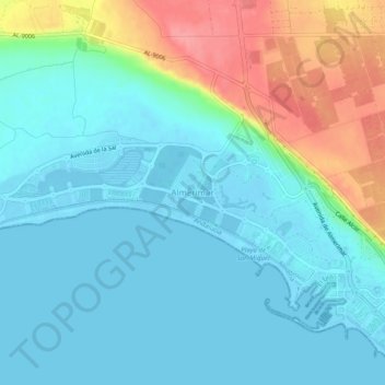
Name: Almerimar topographic map, elevation, terrain.

Location: Almerimar, El Ejido, Almería, Andalucía, 04711, España (36.68787 -2.82746 36.72787 -2.78746)

Average elevation: 23 m

Minimum elevation: -4 m

Maximum elevation: 90 m

Other topographic maps

Click on a map to view its topography, its elevation and its terrain.

Parque Biblioteca

España > Andalucía > El Ejido

Average elevation: 78 m

Gear up for your next adventure:

🔨Vehicle Emergency Tool - Safety tool for remote road trips to trailheads
🧥Softshell Hiking Jacket - The perfect balance of wind protection and breathability
🕶️Polarized Sunglasses - Protect your eyes with durable polarized lenses
🧴Waterproofing Spray - Restore the DWR coating on jackets and tents
🥾Lightweight Hiking Boots - Boots for comfort and mobility on long hikes

As an Amazon Associate, this site earns from qualifying purchases at no extra cost to you.