Geolocate

Cuchilla Roa topographic map

Click on the map to display elevation.

About this map

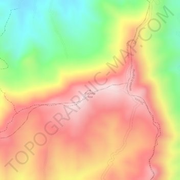
Name: Cuchilla Roa topographic map, elevation, terrain.

Location: Cuchilla Roa, Sutamarchán, Ricaurte, Boyacá, 153880, Colombia (5.58940 -73.58587 5.58950 -73.58577)

Average elevation: 2,366 m

Minimum elevation: 2,132 m

Maximum elevation: 2,533 m

Other topographic maps

Click on a map to view its topography, its elevation and its terrain.

Curubal

Colombia > Boyacá > Sutamarchán

Average elevation: 2,836 m

Gear up for your next adventure:

💧Reusable Water Bottle - Durable water bottles for hydration on trails
🧥Ultralight Puffy Jacket - Maximum warmth that packs down to the size of an orange
🧴Outdoor Sunscreen - High SPF protection for high-altitude UV exposure
🦯Trekking Poles - Reduced impact on joints for steep topographic climbs
🔋Lithium AA Batteries - Long-lasting power that performs in extreme cold

As an Amazon Associate, this site earns from qualifying purchases at no extra cost to you.