Geolocate

Iron River topographic map

Click on the map to display elevation.

About this map

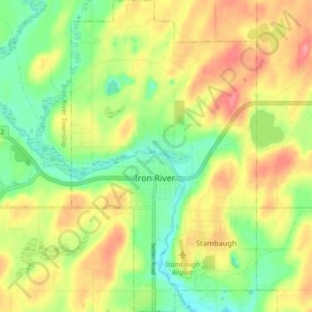
Name: Iron River topographic map, elevation, terrain.

Location: Iron River, Iron County, Michigan, United States (46.06897 -88.66383 46.12363 -88.61685)

Average elevation: 479 m

Minimum elevation: 441 m

Maximum elevation: 521 m

Other topographic maps

Click on a map to view its topography, its elevation and its terrain.

Gear up for your next adventure:

🧦Outdoor Socks - Durable socks designed for hiking and outdoor sports
💡Portable Camping Lamp - Rechargeable lamp for campsite lighting
🚲Bike Repair Kit - Essential tools for on-trail mechanical issues
🕶️Polarized Sunglasses - Reduces glare from snow and water at high elevations
🛰️Satellite Messenger - Emergency communication for areas with no cell service

As an Amazon Associate, this site earns from qualifying purchases at no extra cost to you.