
Thank you for supporting this site ❤️
Make a donation
Make a donation
Gear up for your next adventure:
As an Amazon Associate, this site earns from qualifying purchases at no extra cost to you.
Gachocho topographic map
Click on the map to display elevation.
Thank you for supporting this site ❤️
Make a donation
Make a donation
Gear up for your next adventure:
As an Amazon Associate, this site earns from qualifying purchases at no extra cost to you.
About this map
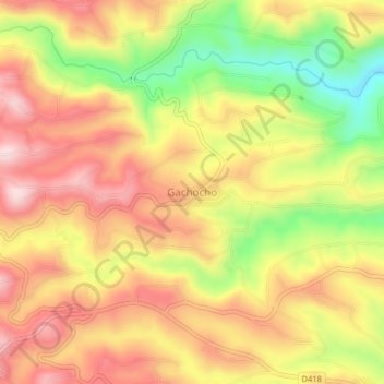
Name: Gachocho topographic map, elevation, terrain.
Location: Gachocho, Kinyona ward, Kigumo, Murang'a County, Kenya (-0.80587 36.96742 -0.76587 37.00742)
Average elevation: 1,662 m
Minimum elevation: 1,475 m
Maximum elevation: 1,800 m
Thank you for supporting this site ❤️
Make a donation
Make a donation
Gear up for your next adventure:
As an Amazon Associate, this site earns from qualifying purchases at no extra cost to you.