Geolocate

Santa Fe topographic map

Click on the map to display elevation.

About this map

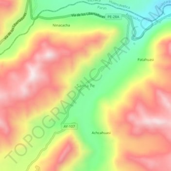
Name: Santa Fe topographic map, elevation, terrain.

Location: Santa Fe, Paras, Province of Cangallo, Ayacucho, Peru (-13.39035 -74.69764 -13.35035 -74.65764)

Average elevation: 4,522 m

Minimum elevation: 4,188 m

Maximum elevation: 4,817 m

Gear up for your next adventure:

🎒Fully Waterproof Backpack - Total protection for photography gear and electronics
🥾Waterproof Trail Shoes - Shoes designed to handle wet terrain
🔋Emergency Crank Radio - Weather alerts and power without needing batteries
🥾Waterproof Hiking Boots - Boots keeping your feet dry in wet conditions
🧥Waterproof Pants - Keep dry during rainy hiking conditions

As an Amazon Associate, this site earns from qualifying purchases at no extra cost to you.