
Thank you for supporting this site ❤️
Make a donation
Make a donation
Gear up for your next adventure:
As an Amazon Associate, this site earns from qualifying purchases at no extra cost to you.
Paro topographic map
Click on the map to display elevation.
Thank you for supporting this site ❤️
Make a donation
Make a donation
Gear up for your next adventure:
As an Amazon Associate, this site earns from qualifying purchases at no extra cost to you.
About this map
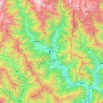
Name: Paro topographic map, elevation, terrain.
Location: Paro, Wangchang Gewog, Paro District, 12001, Bhutan (27.27077 89.25299 27.59077 89.57299)
Average elevation: 3,241 m
Minimum elevation: 2,069 m
Maximum elevation: 5,090 m
Thank you for supporting this site ❤️
Make a donation
Make a donation
Gear up for your next adventure:
As an Amazon Associate, this site earns from qualifying purchases at no extra cost to you.